Thamel, Bhagwati Marg, Kathmandu

Manaslu Circuit Trek

From: $1316 /Person
Manaslu Region
(4 Reviews)
Best Price

US$ 1250.2

Duration

16 Days

Destination

Manaslu Region

Seson

Feb-May & Aug-Nov-dec

Difficulty Level

Challenging

Max Altitude

5,106 m Larke Pass

Activity

Trekking

Transportation

Car | Jeep | Hiace

Itinerary

Time
Whole Day
Max Altitude
1,400 m
  • Landing at Tribhuvan International Airport: Once you've landed and completed your check-in, you will be greeted by one of our representatives at the terminal in TIA.
  • Transfer to Hotel: You will be then transferred to a hotel.
  • Briefing about the Trek: One of our representatives will provide a brief overview of your upcoming journey, detailing the itinerary and important information neccessary before the trek.
  • Visit Thamel: If you’re up for it, enjoy a short stroll through the vibrant streets of Thamel, known for its shops, cafes, and lively atmosphere.
  • Overnight Stay: Spend the night at a hotel in Kathmandu, preparing for your adventure ahead.
Time
Whole Day
Max Altitude
1,400 m

Morning Start your day with a relaxed breakfast at the hotel, nothing fancy, just good food to fuel up for the day.

Kathmandu Valley Highlights Head out to see some of the valley’s most iconic spots (all UNESCO World Heritage Sites):

  • Kathmandu Durbar Square – The old royal palace area filled with ancient temples, carved wooden windows, and lively squares.
  • Patan Durbar Square – A masterpiece of Newari architecture with beautiful temples, stone carvings, and a peaceful museum.
  • Bhaktapur Durbar Square – Known for its stunning 55-window palace, the golden entrance gate, and the nearby Pottery Square where you can watch potters at work.
  • Swayambhunath (Monkey Temple) – A peaceful stupa perched on a hill with sweeping views over the city, monkeys everywhere, and a wonderful mix of Hindu and Buddhist vibes.

Trekking Permit Stop by the Department of Immigration office in the afternoon to sort out your trekking permits (TIMs card or restricted area permit, depending on your route). It usually doesn’t take too long if you have your paperwork ready.

Evening Back to your hotel in Kathmandu for a good night’s rest after a full first day.


Time
10 hr
Max Altitude
900 m
  • Early Morning Start Rise early, enjoy a proper breakfast at the hotel (dal bhat, toast, eggs, whatever gets you going), and set off before the city wakes up fully.
  • Road Trip West You’ll follow the Kathmandu–Pokhara Highway for the first stretch, passing rivers, green hillsides, and typical roadside Nepal scenes. After a couple of hours you branch off toward Dhading Besi, then continue climbing into the Budhi Gandaki Valley via Soti Khola. The road soon changes from smooth asphalt to rough, dusty dirt track. Expect small villages with thatched or grass roofs, terraced fields, suspension bridges, and people carrying loads or herding goats along the way.
  • First Glimpses of the Big Mountains As you gain height and the road twists higher, the real views kick in: sweeping panoramas of the southern slopes of Annapurna, the massive bulk of Manaslu, Ganesh Himal, and sometimes parts of Langtang in the distance. Snow peaks rising straight out of deep green valleys, it’s the kind of scenery that makes the long, bumpy ride feel worthwhile.
  • Arrival in Machha Khola After roughly 8–10 hours on the road (depending on traffic, road conditions, and short stops), you reach Machha Khola at about 900 m. It’s a quiet little riverside village tucked in the narrow Budhi Gandaki gorge, basic, friendly, and the official starting point for most Manaslu treks.
  • Overnight Check into a simple teahouse or lodge near the river. Expect a basic room, shared bathrooms, maybe a hot shower if the solar is working, and a hearty plate of dal bhat for dinner. Early to bed—tomorrow you finally start walking.


Time
6 - 7 hr
Max Altitude
1,290 m
  • Scenic Highlights Along the Way The trail hugs the roaring Budhi Gandaki River through a dramatic narrow gorge, with plenty of eye-catching sights to keep things interesting. Look out for cascading waterfalls tumbling down the cliffs, the striking Buddha cliff (a massive rock face with natural formations that locals say resemble Buddhist icons), and the natural hot springs at Tatopani—perfect for a quick dip if you're feeling the heat from the walk (the water's warm and sulfur-rich, great for sore muscles).
  • Trek Details Expect 6–7 hours of steady trekking today, with a good mix of gentle ups and downs, no extreme climbs yet, but the path is mostly rocky and uneven in spots. You'll follow the river closely, crossing suspension bridges and passing through lush, forested sections where the gorge walls tower overhead.
  • Villages & Local Vibes The route winds through several small settlements like Tatopani (the hot springs spot), Dovan, and Thulo Dhunga. These are classic Gurung villages with stone houses, terraced fields, and friendly locals, stop for a chai or chat if you can; it's a nice intro to the region's culture before things get more remote.
  • Arrival in Jagat You reach Jagat at around 1,290–1,380 m (depending on the exact lodge). This marks your official entry into the Manaslu Conservation Area—it's the first village with strong Tibetan Buddhist influence, complete with prayer flags, a checkpost for permits, and a noticeable shift in architecture and atmosphere. It's a pretty spot tucked against the cliffs, with the river rushing below.
  • Overnight Settle into a cozy teahouse or lodge in Jagat. Rooms are basic (twin beds, shared bathrooms), but the food is hearty, dal bhat is king here, and you'll get a good rest after your first full day of walking. Early night recommended; the trek ramps up gradually from here.


Time
6 - 7 hr
Max Altitude
1,865 m
  • Morning Climb to Salleri The day starts with one of the tougher sections: a steep, steady ascent over rocky paths for about 2–3 hours up to Salleri (around 1,440 m). The trail is narrow in places with some loose stones, so take it slow and steady—great views back down the gorge and up toward the surrounding ridges make the effort worthwhile. You'll feel the altitude starting to build a little here.
  • Descent to Sirdibas & River Crossing From Salleri, the path drops down more gently to Sirdibas, a small Gurung settlement. After a short rest (maybe a cup of chai at a local shop), you continue along the river toward Ghatta Khola. Here you cross a long, swinging suspension bridge over the Budhi Gandaki, classic Nepal trekking moment with the river roaring far below. On the other side, the trail leads you up to Philim (around 1,590 m), a larger village with a school, shops, and a mix of stone houses and fields.
  • Onward to Deng From Philim, head north through pretty millet terraces and open farmland. The path passes Ekle Bhatti (a small settlement with a few teahouses, good for a quick snack or drink), then enters quieter sections of grassland, bamboo groves, and scattered pine trees. The gorge opens up a bit, the trail becomes wider and less rocky, and the river stays close by on your left. It's a peaceful stretch with fewer steep bits, perfect for soaking in the changing scenery as you move deeper into the Manaslu region.
  • Arrival in Deng You cross the side stream of Deng Khola on another bridge and arrive in Deng village at about 1,865 m. It's a compact Tibetan-influenced settlement with traditional flat-roofed stone houses, prayer flags fluttering, and a real sense of being in the heart of the valley. The atmosphere feels noticeably more remote than the earlier villages.
  • Overnight Check into a local teahouse in Deng, basic but warm and welcoming. Expect simple twin rooms, shared facilities, and the usual hearty meals (dal bhat with extras like veggies or buffalo curry if you're lucky). Rest up well; tomorrow brings more gradual gains and even better mountain views.


Time
6 - 7 hr
Max Altitude
2,630 m
  • Leaving Deng Behind Start the day by crossing the Budhi Gandaki River on a sturdy bridge right out of Deng. The trail immediately begins to climb gently away from the village, leaving the lower gorge behind as you enter a more open, scenic valley.
  • Ascent to Ghap The path winds steadily uphill through a beautiful stretch of the valley. You'll pass a handful of tiny settlements and come across plenty of Tibetan-style mani walls and chortens—stone walls beautifully carved with Buddhist mantras and prayers. It's a peaceful, spiritual section with the river tumbling below and green hills rising around you. Ghap (around 2,160 m) is a compact village with traditional stone houses and a relaxed vibe—perfect for a short tea break.
  • On to Prok From Ghap, the trail continues north with increasingly impressive views. As you approach Prok (around 2,390 m), the massive white peak of Singri Himal (also called Shringi Himal) starts dominating the skyline ahead—it's one of the standout mountain sights on this stretch. Prok itself is a small Tibetan-influenced hamlet with flat-roofed homes and prayer flags; the scenery here feels wilder and more remote.
  • Through the Forests & River Crossings Beyond Prok, the trail enters thicker woodland—dense stands of fir, oak, and rhododendron trees (beautiful if you're trekking in spring when the rhodies are blooming). The path crosses the Budhi Gandaki several times via wooden bridges or suspension bridges, with the river getting narrower and faster as you gain height. The terrain is mostly steady uphill with some short steeper bits, but nothing too punishing.
  • Final Push to Namrung The last section involves a noticeable steep climb to reach Namrung at about 2,630 m. As you top out, the views explode: sweeping panoramas of Ganesh Himal (with its dramatic peaks), the pointed summit of Mount Hiunchuli (Himchuli), and the elegant Singri Himal in the distance. Namrung is one of the prettiest stops on the trek—stone houses, apple orchards in season, and a real sense of having entered the higher Himalaya.
  • Overnight After roughly 6–7 hours of trekking, check into a comfortable teahouse or lodge in Namrung. Rooms are still basic but usually a bit nicer than lower down (better views from the windows), and the food stays hearty—dal bhat with local twists, maybe some buckwheat dishes or fresh veggies. Get a good night's sleep; the next few days bring even higher altitudes and more dramatic scenery.


Time
5 - 6 hr
Max Altitude
3,180 m
  • Trek to Lho Gaun After breakfast, set off on a pleasant 5–6 hour walk that gradually gains altitude. The trail is mostly gentle to start, climbing through open fields and small settlements. One of the highlights is passing an impressive long mani stone wall—rows of carved stones with Buddhist prayers and symbols—lining the path as you near Lho Gaun (also called Lho or Lho Gaon) at about 3,180 m. The village feels like a proper high-Himalayan settlement: traditional Tibetan-style stone houses with flat roofs, prayer flags fluttering everywhere, and yaks grazing nearby. The views start opening up more dramatically here.
  • Side Trip to Pungen Glacier Viewpoint Once you reach Lho Gaun and drop your bags at the teahouse, many trekkers head out for the rewarding side climb to the Pungen Glacier viewpoint (sometimes called the Manaslu Base Camp viewpoint lower section). This takes 2–3 hours round trip: a steady uphill scramble along a mountainside path to reach the crest overlooking the glacier. From up there, you get an incredible close-up of the Pungen Glacier tumbling down from Peak 29 (also known as Manaslu East or the "twin" peak), with huge icefalls and seracs. The real payoff is the unobstructed, jaw-dropping panorama of Mount Manaslu itself—its massive snowy face looming straight ahead, often with clouds swirling around the summit. It's one of the most photogenic and memorable spots on the entire trek.
  • Return to Lho Gaun Descend the same path back down to the village in time for late afternoon or early evening. The downhill is easier on the legs, and you'll have plenty of time to relax, enjoy a hot drink, or wander around the village.
  • Cultural Immersion Lho Gaun is a great place to soak up authentic Tibetan-Buddhist Himalayan life. Watch locals spinning prayer wheels, herding yaks and dzos (yak-cow hybrids), or working in small fields. You might see women in traditional chuba dresses, kids playing, or monks going about their day at the small gompa (monastery). It's a peaceful, unhurried atmosphere—chat with the teahouse family if you can; they often share stories about life in this remote valley.
  • Overnight Settle in for the night at a teahouse in Lho Gaun. These are usually a step up from lower villages—rooms with better insulation against the chill, maybe even some solar-powered lights or charging points. Dinner will be hearty (dal bhat, maybe some momos or noodle soup), and the mountain views from the dining area or your window are unbeatable. Rest well; tomorrow you head toward Sama Gaon, with even closer encounters with Manaslu.


Time
4 - 5 hr
Max Altitude
3,530 m
  • Early Morning Departure Get an early start after breakfast—ideally on the trail by 7 or 8 AM—to make the most of the clear morning light and avoid any afternoon clouds that often roll in around Manaslu. The path heads north out of Lho Gaun, climbing gradually at first with fantastic backward views of the peaks you've already passed.
  • Through the Forest to Shyala The trail enters a lovely stretch of mixed forest—pine, fir, and rhododendron—before opening up into more open terrain. After a couple of hours, you arrive at Shyala (also spelled Syala or Shyala) at around 3,500 m. This pretty little village is surrounded by barley and buckwheat fields (golden in season), with wooden benches and chortens scattered around—great spots to catch your breath and take in the scenery. The views of Manaslu start getting really close from here, and you might spot yaks or dzos grazing in the pastures.
  • Crossing the Pungen River & Final Stretch From Shyala, the path continues fairly level or with gentle ups and downs, crossing a small side stream fed by the Pungen Glacier (you'll see its icy snout high up on the mountainside to your right). The valley widens out dramatically, and soon the flat, open expanse of Sama Gaon (Samagaun) comes into view below you. The village sits at about 3,530–3,540 m on a broad plateau, surrounded by high peaks and close to the route toward Manaslu Base Camp. It's one of the larger and most important settlements in the upper valley—think stone houses with flat roofs, multiple gompas, shops, and a real community feel.
  • Arrival in Sama Gaun After roughly 4–5 hours of trekking (mostly moderate with a few short steeper bits), you reach Sama Gaon. Drop your pack, check in, and enjoy the sense of accomplishment— you're now deep in the heart of the Manaslu region, with the mountain itself dominating the skyline. The air is crisp, the pace is slower, and the altitude starts to make itself felt, so take it easy this afternoon.
  • Overnight Settle into a teahouse or lodge in Sama Gaon. These are usually quite comfortable by trekking standards—good rooms, decent food (dal bhat, Tibetan bread, maybe some local buckwheat pancakes), and often solar hot water or charging. Many places have sunny dining areas with killer views of Manaslu. Use the rest of the day to relax, explore the village, visit the old monastery, or just soak up the atmosphere. Acclimatization is key here before heading higher tomorrow.


Time
Whole Day
Max Altitude
3,450 m
  • Acclimatization Day: Take a day to rest and acclimatize in Samagaun as you’ve reached higher elevations. Use this time to adjust to the altitude while exploring the village.
  • Cultural Exploration: Discover the local lifestyle and customs of the people living in Samagaun.
  • Optional Activities:
    • Hike to Manaslu Base Camp: Explore the base camp for stunning views of Mount Manaslu.
    • Visit Birendra Lake: A beautiful glacier-fed lake at 3,450 meters, where slabs of ice crash into the water in spectacular fashion.
    • Pungyen Monastery: A 1.5-hour hike south of Samagaun takes you to this secluded monastery, offering incredible mountain vistas.
Time
5 - 6 hr
Max Altitude
3,875 m
  • Trek to Samdo (3,875 m): Continue your journey toward Samdo. Today's 5-6 hour trek is both fascinating and enjoyable as you cross pastures and climb through the valley, surrounded by juniper and birch trees.
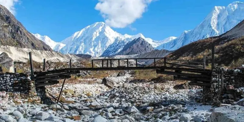
  • River Crossing and Ascent: Descend to the Budhi Gandaki River, cross it via a wooden bridge, and then ascend sharply on the other side.
  • Arrival at Samdo: Reach Samdo, a Tibetan refugee village, where you'll be greeted with breathtaking views of the Himalayas, especially Mount Manaslu.
  • Explore Samdo: After arriving, explore the village and nearby hills before settling in for an overnight stay at a teahouse or lodge.
Time
Whole Day
Max Altitude
5,000 m

Optional Hike Toward the Tibet Border Instead of staying completely still, many people opt for a gentle acclimatization hike north from Samdo toward the old trade route and the Nepal–Tibet (China) border area. The trail climbs steadily for 2–4 hours round trip (depending how far you go), gaining around 800–1,000 m to reach viewpoints at roughly 4,600–5,000 m. It's not a strenuous climb—mostly open pastures, rocky paths, and wide valley views—but the extra height really helps your body produce more red blood cells for the days ahead.

The payoff is spectacular: sweeping panoramas across the border into Tibet, with distant peaks in the Tibetan plateau, plus closer looks at Manaslu, Ngadi Chuli, and the dramatic Larkya La pass area ahead. You might spot blue sheep or Himalayan marmots along the way, and the sense of standing at the edge of two countries is pretty special. Turn around whenever you feel ready—no need to reach any specific point; the goal is exposure to higher altitude, not distance. Bring layers, water, snacks, and sunscreen—the sun is intense up there.

Afternoon Back in Samdo Return to the village by early to mid-afternoon. Use the rest of the day to relax: read in the sun, chat with other trekkers, visit the local shop for snacks, or just enjoy the village atmosphere. Samdo's Tibetan refugee community adds a unique cultural layer—watch for prayer wheels turning, kids playing, or families preparing tsampa (roasted barley flour). It's a quiet, reflective spot perfect for recharging mentally and physically.

Overnight Another night at your teahouse or lodge in Samdo. The stone buildings hold warmth well, and most places have a cozy common area with a stove—ideal for an early dinner (dal bhat, momos, or soup) and an early bedtime. Tomorrow you head to Dharmasala (Larkya Phedi) at around 4,460 m, so rest up well; the pass crossing is getting close.


Time
4 - 5 hr
Max Altitude
4,460 m


  • Leaving Samdo Behind Start early after breakfast to catch the crisp morning light and clear views. The trail heads north out of Samdo, climbing gently at first through wide alpine pastures where yaks and dzos graze. You'll pass historic mani walls—long rows of carved prayer stones—and old chortens, adding a spiritual touch to the walk. The village quickly fades behind you as the valley opens up, with the high peaks closing in and the air getting noticeably thinner.
  • Ascent Toward the Larkya La Area The path continues steadily uphill, mostly on a good dirt track with some rocky sections. After a while, you'll drop briefly to cross an ancient wooden bridge over the Budhi Gandaki River (the "crossroads" feel comes from old trade routes meeting here). On the far side, the trail ascends more noticeably. You'll cross two smaller side streams (one often the Salka Khola), passing through the narrow Salka Khola valley with its dramatic rocky walls and occasional juniper bushes. The landscape feels increasingly wild—open scree slopes, distant glaciers, and the first clear sight of the massive Larkya Glacier spilling down from the pass ahead.
  • Arrival at Dharmasala (Larkya Phedi) After about 4–5 hours of steady climbing (around 600–700 m gain), you reach Dharmasala, also known as Larkya Phedi, at approximately 4,460–4,480 m. This isn't a proper village—just a cluster of basic stone teahouses/lodges set on a windy moraine shelf near the foot of the Larkya La pass. The location is stark and beautiful: barren rocky terrain, the glacier visible nearby, and towering peaks all around. It's cold and exposed up here, so the sense of being on the edge of high adventure really hits.
  • Afternoon at Dharmasala Settle in early—there's not much to do except rest, hydrate heavily (aim for lots of tea and water), and prepare mentally and physically for tomorrow's pass crossing. The altitude is significant, so take it very easy: no unnecessary exertion, eat what you can, and keep warm. Many trekkers use this afternoon to chat with others, check gear, or just watch the changing light on the surrounding mountains. Sunset and sunrise views from here can be spectacular if the weather cooperates.
  • Overnight Stay at one of the simple local lodges or teahouses in Dharmasala. Expect very basic facilities—dorm-style rooms or twin beds with thick blankets (it gets freezing at night), shared toilets (often squat-style outside), and a common dining area with a stove for warmth. Food is straightforward (dal bhat, soup, pasta, Tibetan bread), but portions are generous to fuel you for the big day ahead. Get to bed as early as possible—most groups aim to start the pass crossing around 4–5 AM tomorrow to avoid afternoon winds and possible bad weather.


Time
7 - 9 hr
Max Altitude
5,106 m


  • Anticipated Big Day This is the highlight and toughest day of the Manaslu Circuit: crossing the iconic Larkya La Pass at 5,106 m—one of the most scenic and dramatic high passes in the Nepal Himalaya. Expect a long 7–9 hour day (sometimes longer depending on conditions and group pace), with significant altitude gain and loss. Start very early—most groups leave the teahouse between 4:00 and 5:00 AM with headlamps—to beat the strong afternoon winds that often whip up around the pass and to enjoy clearer morning views.
  • Early Morning Ascent From Dharmasala (Larkya Phedi), the trail begins in the dark on rocky, loose moraine terrain. Headlamps light the way as you climb steadily uphill, passing prayer flags fluttering in the cold pre-dawn air. The path is well-trodden but uneven—lots of small rocks and scree—so trekking poles are very helpful for balance. As daylight breaks, the landscape opens up dramatically: vast glacial valleys, icefalls, and the first golden light hitting the surrounding peaks. The climb is gradual at first but gets steeper in sections; take slow, steady steps and breathe deeply to manage the thin air.
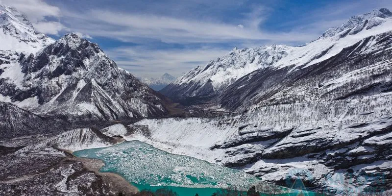
  • Descent to the Frozen Lakes & Final Push to the Pass After a couple of hours, the trail levels briefly and drops slightly to a series of four small frozen (or partially frozen) lakes nestled in a high basin—stunning in the early light with their icy surfaces reflecting the mountains. From here, the real ascent resumes: a steady, relentless climb over rocky ridges and loose scree toward the pass. The last 200–300 m feel the toughest due to altitude, but the views keep getting better—panoramas open up of Himlung Himal (7,126 m), Cheo Himal, Gyaji Kang, and Annapurna II (7,937 m) towering in the distance, with the Larkya Glacier sprawling below. Prayer flags mark the top—reach the pass (5,106 m) usually around 8–10 AM, depending on your start time. Take a moment to celebrate, snap photos, and soak in the 360-degree Himalayan vista—it's often windy and cold, so layer up.
  • Descent to Bhimtang The initial descent from the pass is gentle for a short stretch across a high plateau with amazing views back toward the pass and forward into the Dudh Khola valley. Then the trail drops steeply—loose scree and rocky steps make it demanding on the knees (trekking poles essential here). After losing significant height, the path becomes easier: wider, less rocky, and eventually grassy as you enter alpine meadows. The scenery shifts from barren high-altitude rock to greener valleys with rhododendron bushes and distant forests. The final stretch to Bhimtang feels long after the pass effort, but the landscape is beautiful and the air gets warmer and more oxygen-rich.
  • Arrival in Bhimtang You reach Bhimtang (also spelled Bimthang) at around 3,720–3,790 m after 7–9 hours total. This remote, high meadow settlement is marked by long mani walls, a few stone chortens, scattered teahouses, and yak pastures—it's a peaceful, almost magical spot after the intensity of the pass. The village sits in a broad valley with towering peaks all around, including views back toward Manaslu and the pass you just crossed. Drop your pack, stretch out, and enjoy the sense of accomplishment—you've just completed one of Nepal's classic high passes.
  • Overnight Settle into a teahouse in Bhimtang. These are basic but welcoming—stone buildings with cozy common areas, twin rooms with extra blankets (nights are still cold), and shared facilities. The food will taste especially good after the big day: hearty dal bhat, garlic soup (great for recovery), Tibetan bread, or noodle dishes. Most trekkers crash early—your legs will thank you. Tomorrow the trek eases up as you head down toward the Marsyangdi Valley and civilization.


Time
7 - 8 hr
Max Altitude
1,860 m


  • Sunrise over Bhimtang Wake up early if the weather cooperates—Bhimtang's high meadow often delivers a magical sunrise, with the first light painting the surrounding snow-capped peaks (including glimpses back toward Manaslu and the Larkya La area) in soft pinks and golds, while morning fog drifts through the valley below. Grab a quick breakfast (hot tea and porridge hit the spot), soak in the views one last time, and set off on what’s usually a much easier, downhill day.
  • Scenic Descent Through the Forests The trail leaves Bhimtang heading south, dropping steadily through lush rhododendron and pine forests—dense green canopies, moss-covered trees, and the sweet scent of pine in the air. You follow the beautiful Dudh Khola (Milk River), famous for its striking milky turquoise color from glacial silt—stunning when the sun hits it just right. The path is mostly gentle downhill with some rocky sections and occasional stone steps; the air feels richer with oxygen as you lose altitude, and the scenery shifts from high alpine to more temperate forest.
  • Lunch Stop at Soti Khola After 3–4 hours of walking, you reach Soti Khola (not to be confused with the earlier trek's Soti Khola on the Manaslu side). This small settlement by the river is a perfect lunch spot—most teahouses serve up hearty dal bhat, noodle soup, or fried rice. Take a break to rest your legs (the downhill can be tough on knees), refill water, and enjoy the riverside setting.
  • Through Villages to Tilije Refreshed, continue descending past the small villages of Homu (or Homuk) and Gho. These are quiet Gurung settlements with traditional stone houses, terraced fields, and a laid-back vibe. Keep an eye out for langur monkeys swinging through the trees or foraging in the fields—they're common in this stretch and add a fun wildlife element. From Gho, the trail passes through open meadows and farmland before reaching Tilije (also spelled Tilje) at around 2,300 m. Tilije is known locally for its homemade raksi (rice or millet brandy)—some teahouses offer a small taste if you're curious (it's strong and warm on a cool day!).
  • Final Stretch to Dharapani From Tilije, the path continues mostly level or gently down, crossing a few mani walls (prayer-carved stones) and passing through Thonje (or Thanchowk) village—a pretty spot with more stone houses and suspension bridges. The valley widens here as you enter the lower Marsyangdi area, with bigger rivers, more vegetation, and signs of civilization returning (roads, vehicles, etc.). After another hour or so, you arrive in Dharapani at about 1,960 m—this is a key junction village where the Manaslu Circuit meets the Annapurna Circuit, complete with teahouses, shops, and a permit checkpost.
  • Overnight Settle into a comfortable teahouse or lodge in Dharapani. After the high mountains, these feel almost luxurious—hot showers (often solar-powered), better Wi-Fi in some places, and a lively atmosphere with trekkers from both circuits. Celebrate with a good meal (maybe try some local trout if available) and reflect on the incredible journey so far. Rest well; tomorrow is usually a shorter walk to Chame or further down the valley, depending on your itinerary.
Time
6 - 7 hr
Max Altitude
1,400 m
  • Morning Drive: After breakfast, drive to Besi Sahar, marking the end of your trek.
  • Journey to Kathmandu: After a brief stop, board the vehicle for the return drive to Kathmandu along the Prithvi Highway. Enjoy the scenic views as you pass the confluence of the Marsyagdi and Trishuli rivers, taking in the stunning landscapes of terraced plains and towering hills.
  • Arrival in Kathmandu: Upon arrival in the bustling capital, take time to refresh and relax.
  • Evening Exploration: Explore the vibrant streets of Thamel Market in the evening, savoring local spices, dishes, and beverages of your choice.
  • Farewell Dinner: Enjoy a farewell dinner with our representatives, reminiscing about your unforgettable experiences in the Manaslu region. Overnight at your hotel.
Time
N/A
Max Altitude
N/A


Final Morning in Kathmandu Take it easy today, sleep in if you like, enjoy one last breakfast at your hotel (maybe treat yourself to some fresh momos or a strong Nepali chai), and reflect on the incredible adventure you've just completed. If you have a bit of free time, you could do some light souvenir shopping in Thamel for last-minute gifts (pashmina shawls, singing bowls, or handmade jewelry) or just relax in a café with mountain views.

Airport Transfer A few hours before your scheduled international flight (usually 3–4 hours prior, depending on traffic and check-in requirements), our friendly airport representative will meet you at your hotel lobby. They'll handle your luggage, escort you to the vehicle, and drive you to Tribhuvan International Airport (KTM) in Kathmandu. The ride usually takes 30–45 minutes from most central areas, but allow extra buffer time during peak hours or festivals.

Farewell & Safe Travels At the airport, your representative will assist with check-in if needed, then wave you off as you head through security. You've trekked one of Nepal's most rewarding and remote circuits, crossing high passes, staying in ancient villages, and standing in the shadow of giants like Manaslu. It's been an honor to help bring this journey to life.

We wish you safe flights, happy landings, and endless more adventures ahead. Until the next trail, namaste and keep exploring!


Overview

Overview

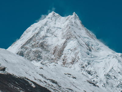
The Manaslu Circuit Trek isn’t just another Himalayan walk,it’s one of Nepal’s most stunning adventures. You circle Mount Manaslu, the eighth-highest mountain in the world at 8,163 meters, on a trail that stretches about 177 kilometers. Most people spend two to three weeks on the trek, depending on their pace and whether they tack on side trips like the Tsum Valley.


Route & Experience

You start in the warm, green lowlands around Soti Khola or Arughat, then slowly climb through thick forests, terraced farms, and peaceful Gurung and Tibetan villages. The scenery just keeps changing until you finally reach the rugged high-alpine world. The real payoff comes at Larkya La Pass, 5,106 meters up, where the whole panorama of Manaslu, Himalchuli, and other snow giants opens up right in front of you. After that, it’s all downhill until you reach the Annapurna region near Dharapani or Besisahar.


Permits & Trekking Style

Because the Manaslu Circuit is a restricted area, you need special permits and must have a licensed guide. No solo trekking here. That means fewer people on the trail, which helps keep the wilderness wild and the local culture intact.


Daily Trekking Conditions

Get ready to walk six to eight hours a day,sometimes over swinging bridges, up ancient stone steps, across wild moraines, or through tiny villages where teahouses offer basic beds and warm plates of dal bhat. You might spot blue sheep or a Himalayan tahr, especially in the conservation areas. This trek is no walk in the park,it’s tough, with long days and real altitude,but if you want real solitude, honest cultural encounters, and jaw-dropping mountain views, it delivers.


Why Choose Manaslu

So, why pick Manaslu over the usual Everest or Annapurna routes? Here’s the thing: Manaslu feels like the real deal. Fewer trekkers are allowed each day, so you get quiet trails, not crowds. Most days, you’ll only bump into a handful of other groups. That gives you space to actually talk with locals in villages like Lho, Samagaun, or Samdo. Buddhist monasteries, spinning prayer wheels, and an old way of life still feel untouched by mass tourism.


Scenery, Culture & Cost

Every day on this trek is different. One day you’re in lush gorges with waterfalls, the next you’re crossing barren high passes beneath towering peaks. If you love photography or wildlife, you’re in the right place,rare plants and animals are everywhere. Compared to the more famous routes, Manaslu is less commercial, easier on the wallet (figure $1,200–$1,800 for permits, guide, and everything else), and packed with cultural variety. Down low, it’s Hindu heartland,up high, it’s pure Tibetan. If you want a true Himalayan adventure,big mountains, real quiet, and deep immersion,Manaslu stands out.


What to Pack

What to pack? Travel light, because either you or your porter will carry everything, and you don’t want to lug more than 10–12 kilos. Take a 40–50 liter backpack and a small daypack for your daily stuff.


Clothing & Gear

Layer your clothes. You’ll need moisture-wicking base layers, quick-dry shirts and pants, a fleece or softshell, and waterproof jacket and pants for the wild weather. Nights get cold, so bring thermal underwear, a down jacket (good to at least -10°C), a warm hat, both liner and insulated gloves, a buff or neck gaiter, and 3–4 pairs of wool socks. Sturdy, broken-in trekking boots with ankle support are a must, plus gaiters for dust or snow.


Essentials & Health

Don’t forget a sleeping bag rated to -15°C,teahouse blankets are hit or miss. Trekking poles help on the steep bits. Bring a headlamp (with extra batteries), sunglasses, and a sun hat. For your health kit: throw in blister plasters, altitude meds like Diamox, painkillers, any personal medications, water purification tablets or a filter, and hand sanitizer. Pack snacks,energy bars, nuts, or chocolate,for long days between meals.


Documents & Extras

Electronics? A power bank, camera, and universal adapter are all useful. Carry passport copies, permits (restricted area, conservation, TIMS), travel insurance that covers high-altitude rescue, and cash in Nepali rupees (don’t count on ATMs up there). Keep toiletries minimal,a quick-dry towel and biodegradable soap are enough. If you don’t want to haul heavy gear from home, you can rent things like sleeping bags and down jackets in Kathmandu.

Best Time to Trek the Manaslu Circuit

If you want to see Manaslu at its best, head there in spring (March to May) or autumn (September to November). Autumn really shines: stable weather, crisp blue skies, and daytime temps that feel just right – usually between 10 and 20°C at lower elevations. Nights get cold, but that only seems to sharpen the mountain views. Trails are busy, teahouses buzz with energy, and local festivals give the whole thing a splash of color.

Spring’s a close second. Days warm up, rhododendrons explode into pink, wildlife comes out, and the hills turn green as the snow melts away. Crowds aren’t bad early on, though you might get some afternoon clouds drifting in. No matter the season, Larkya La pass usually stays clear and the trails hold up well.

Skip the monsoon – June to August brings heavy rain, mud, leeches, and landslides that ruin the views and make hiking miserable. Winter (December to February) is brutal unless you’re a hardcore trekker with serious gear: deep snow blocks the pass, temperatures drop below zero, and most teahouses shut down. For most people, October or April is the sweet spot. Just remember, permits run out fast, so book early.


Preparation Tips for the Manaslu Circuit Trek

Give yourself at least two or three months to get your body ready. Hike five to ten kilometers a few times a week, and don’t skip the hills or stairs – a treadmill on an incline works too. Mix in some strength training: squats, lunges, core work, plus cardio like running or cycling. Throw on a loaded backpack during your walks so your body gets used to the extra weight.

Good itineraries include acclimatization days – usually at places like Samagaun – but listen to your body. If you get a headache, feel nauseous, or dizzy, don’t push it. Go down and let yourself recover. Drink lots of water (three to four liters a day), eat carbs, and take your time going up.

Book with a trusted agency in Kathmandu. You’ll need a guide, permits (budget $100-180 total), and help with logistics – solo trekking isn’t allowed on this route. Get travel insurance that covers helicopter rescue up to 6,000 meters, and check your vaccines (hepatitis, typhoid). Download offline maps, learn a few Nepali greetings, and always ask before taking photos in monasteries.
Highlights

Here are eight real highlights from the Manaslu Circuit Trek that stick with people long after they get back to Kathmandu. These aren't just checklist items,they're the moments that make the whole thing feel special.

  1. The quiet thrill of walking almost alone Most days you barely see other trekkers. The restricted permits keep crowds away, so the trail feels like it's yours. You can stop to catch your breath, listen to the river, or just sit on a rock without anyone rushing past. Compared to Annapurna or Everest, the silence hits different,it's peaceful, almost meditative.
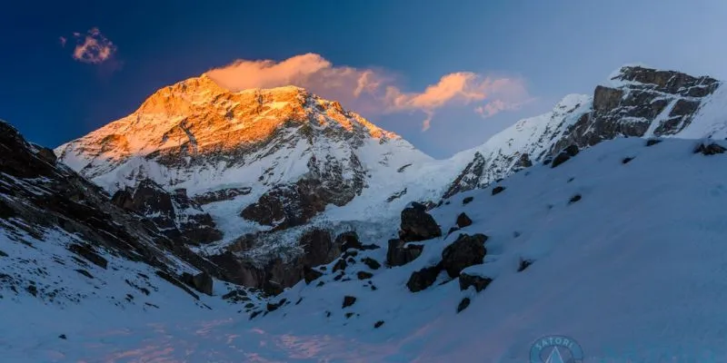
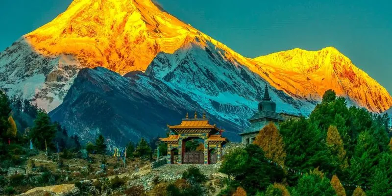
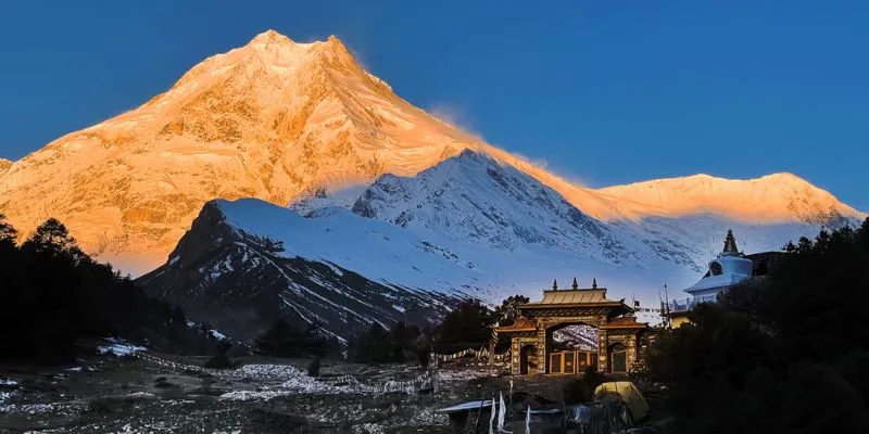
  2. First close-up of Manaslu itself Around Lho or Samagaun, the mountain suddenly dominates the sky. It's massive, intimidating, and beautiful all at once. Early mornings when the light hits the face just right, it glows,people stand there with their tea, staring, not saying much. It's one of those "this is why I came" moments.
  3. Staying in the high villages like Samagaun or Samdo These places feel properly remote. Stone houses, yak dung fires, kids playing in the lanes, old women spinning wool. You eat dinner with the family running the teahouse, hear stories about winter life or the old trade routes to Tibet. The hospitality is genuine,no performance, just people sharing what they have.
  4. Birendra Tal (Lake) near Samagaun A short side walk from the village takes you to this turquoise glacial lake sitting right under Manaslu. The water's so clear you see the bottom, and the reflection of the peak is unreal on calm days. It's a perfect spot to sit for an hour, skip stones, or just breathe after the climb up.
  5. The monasteries and prayer flags everywhere Pungyen Gompa above Samagaun or the little ones in Lho,walking into these quiet, smoky rooms with butter lamps and chanting monks feels timeless. Prayer flags snap in the wind on every ridge, mani walls line the paths. You don't have to be spiritual to feel the weight of centuries here.
  6. Crossing endless suspension bridges The Buri Gandaki gorge is full of them,swaying high above milky rivers, sometimes with waterfalls crashing nearby. Early on they're exciting; later they just become part of the rhythm. Crossing one in mist or wind adds a little adrenaline without being scary.
  7. The push over Larkya La Pass It's tough,long, steep, cold, and high at 5,106 m,but the payoff is huge. Dawn views stretch across Manaslu, Himlung, Cheo Himal, Annapurna II. The sense of achievement when you reach the top, wind howling, flags whipping, is hard to beat. The descent is brutal on the knees, but you feel like you've earned every step.
  8. The shift from deep gorges to open alpine country The trek starts in steamy subtropical forests with banana trees and leeches, then climbs into pine, rhododendron, and finally barren rock and ice. That gradual change keeps everything interesting,no two days look the same. By the end you're in a different world, and linking into the Annapurna side feels like closing a big loop.

Included and Excluded

Included :

  • Accommodation in 3-star hotel in Kathmandu
  • Accommodation in a teahouse or lodge during the trek on a full-board sharing basis (breakfast, lunch, and dinner) during the trek.
  • All the airport transfers in Kathmandu.
  • Special restricted area permit and ACAP, MCAP, and Tims permit for trekking.
  • Transportation from Kathmandu – Machha Khola – Dharapani-Kathmandu.
  • Daily fresh fruits during the trekking , Special Care for Every trekker
  • Experience English-speaking Guides.
  • One porter for every two trekkers.
  • Insurance for guide and porter.
  • Free t-shirts / Trip Map / Farewell Dinner
  • Govt. Taxes and other taxes

Excluded :

  • Nepal entry visa
  • Extra charge if early return from trekking.
  • Tips for guide, porter, and driver.
  • Personal belongings and Expenses
  • All the lunch and dinner in Kathmandu / Rescue and Insurance
  • Additional costs arise due to Natural disasters, Political Disturbances, Problematic conditions, and Epidemics.
  • All the personal expenses water, extra food, mobile and associate charges, internet charges, beverages, etc.
  • Personal assistance for extra costs

Route Map

trip route map for Manaslu Circuit Trek

Frequently Asked Questions

Traveler Reviews

Verified customer feedback

DA

Dhiraj Ale Magar

Jan 25, 2026

★ ★ ★ ★ ★

TEST REVIEW

JT

Johnson Terry

Jan 25, 2026

★ ★ ★ ★ ★

TEST REVIEW TEST REVIEW TEST REVIEW TEST REVIEW TEST REVIEW TEST REVIEW

PC

Pramod Chaudhary

Jan 25, 2026

★ ★ ★ ★ ★

Great Services

SR

Shubaraj Rana Magar

Jan 25, 2026

★ ★ ★ ★ ★

Trusted Travel Agency

How was your experience with us?

★ ★ ★ ★ ★

Related Packages

You May Also Love And Like
pacakge-image
Trekking
5 (4 reviews)
16 Days
14 pax
$1316 /person