
Annapurna Circuit- A Complete Trail Overview
The Annapurna Circuit has been my go-to recommendation for years when someone asks for a trek that delivers everything Nepal has to offer without feeling rushed or overly commercialized. It's not the shortest or the easiest, but if you give it the full 19 days, you get the real deal: starting in the humid green foothills, climbing through pine and rhododendron forests, hitting high alpine meadows, crossing that beast of a pass at Thorong La, dropping into the stark desert-like Kali Gandaki valley, and finally winding back through Gurung villages with those classic Poon Hill sunrise views.
What makes a 19-day version realistic in 2026 is how roads have changed things. The old full circuit on foot from Besisahar all the way around used to take 21+ days, but jeeps now run regularly up the Marsyangdi side to places like Dharapani or even Chame, and down the Kali Gandaki from Jomsom toward Beni or Pokhara. Most people still walk the core sections, the ascent to Manang, the pass crossing, the descent to Muktinath/Jomsom, and the southern leg to Ghorepani/Poon Hill, while using short drives where the trail parallels dusty roads. That keeps the walking meaningful (around 140–180 km total trekking distance) without wasting days on boring road sections.
The route goes anti-clockwise: up the eastern Marsyangdi Valley for gradual acclimatization, over Thorong La (5,416 m), down the western Kali Gandaki (world's deepest gorge), then south through Tatopani and Ghorepani to close the loop near Pokhara. Total elevation gain/loss is massive, over 9,000 m up and down, but spread out properly, it's manageable if you're reasonably fit and take the acclimatization seriously.
Complete Route Information
Here's the day-by-day trail breakdown I've used and tweaked over recent trips. Elevations are approximate (they vary slightly by exact teahouse), walking times assume a steady pace with breaks, and distances are trail km where possible.
Day 1: Arrival & settling in Kathmandu (1,350 m) You land, sort permits (ACAP + TIMS, grab them in Thamel or at the tourism board), maybe wander Durbar Square or Swayambhu if you have energy. Nothing trail-related yet, just rest up for tomorrow's drive.
Day 2: Drive Kathmandu to Dharapani (1,860 m) Long bumpy ride (8–10 hours) via Besisahar. The road follows the Trishuli then Marsyangdi rivers, terraced fields, small villages, glimpses of Lamjung Himal. Many start jeep rides from Besisahar to skip the lower dusty sections. Overnight in Dharapani, a pretty spot with apple trees and first real mountain air.
Day 3: Dharapani to Chame (2,670 m) 5–6 hours, ~15 km. Easy walking along the river, past Bagarchhap (stone houses, hot springs nearby), through pine woods and suspension bridges. Annapurna II starts peeking out. Chame has bakeries, an ATM (last reliable one for a while), and good teahouses.
Day 4: Chame to Upper Pisang (3,300 m) 5–6 hours, ~14 km. Trail climbs steadily, forests give way to open views. Lower Pisang is quicker, but Upper Pisang (short steep climb) gives better acclimatization and killer sunrise over Annapurna II/III. Monastery up there is worth the detour.
Day 5: Upper Pisang to Manang (3,540 m) 5–6 hours, ~14 km. Two options: lower route (faster, road-ish) or upper via Ghyaru/Ngawal (adds ~2 hours, stunning panoramic views of the Annapurnas, less dust). Either way, you arrive in Manang, biggest village here, with shops, bakeries, and that classic gompa vibe.
Day 6: Acclimatization in Manang No big trek, rest day is non-negotiable above 3,500 m. Short side hikes: Gangapurna Lake (1 hour round trip, turquoise water), Praken Gompa viewpoint, or Ice Lake if you're feeling strong (full day, high reward). Visit the Himalayan Rescue Association clinic for altitude talk. Drink tons of water, eat well.
Day 7: Manang to Yak Kharka (4,050 m) 4–5 hours, ~12 km. Gradual climb through juniper scrub and yak pastures. Views open up, Gangapurna, Tilicho Peak looming. Air gets thinner; take it slow. Yak Kharka teahouses are basic but cozy.
Day 8: Yak Kharka to Thorong Phedi / High Camp (4,450–4,900 m) 4–6 hours, ~8–10 km. Steeper now, rocky path, switchbacks. Thorong Phedi is the main base; High Camp (another 400 m up) shortens the pass day and gives epic sunrise. Many push to High Camp for better morning start.
Day 9: Thorong La Pass crossing to Muktinath (5,416 m → 3,800 m) 7–9 hours, ~15–18 km. Start pre-dawn (headlamp needed). Steep 3–4 hours up to the pass, prayer flags flapping, wind biting, 360° panorama: Annapurna I south, Dhaulagiri west, Thorong Peak north. Then long descent, loose scree to start, then easier path to Muktinath. Temple complex here is sacred (108 spouts, eternal flame). Big day, huge sense of achievement.
Day 10: Muktinath to Jomsom (3,800 m → 2,720 m) 5–6 hours, ~18 km. Easy downhill through dry, windy valley, apple orchards, whitewashed villages. Kagbeni detour possible for Mustang views. Jomsom has airport, banks, better food.
Day 11: Jomsom to Marpha / Kagbeni area Short 3–4 hours. Marpha is the highlight, Thakali stone village, apple brandy distilleries, narrow lanes, monastery. Great rest stop after the pass.
Day 12: Marpha to Tatopani (2,670 m → 1,190 m) 6–8 hours or jeep option. Steep descent, canyons deepen, subtropical return. Tatopani's natural hot springs are perfect for sore muscles. Soak, eat well.
Day 13: Tatopani to Ghorepani (1,190 m → 2,860 m) 7–8 hours. Big climb back up, forests, waterfalls, villages like Shikha. Rhododendrons if spring. Ghorepani teahouses cluster near the pass.
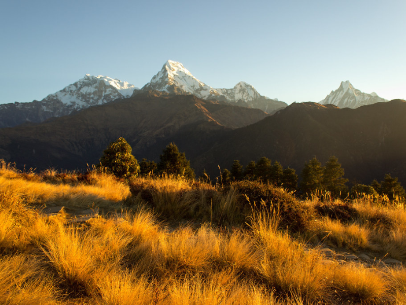
Day 14: Ghorepani to Poon Hill sunrise then Tadapani (3,210 m → 2,630 m) Early 1-hour up to Poon Hill, classic sunrise over Annapurna South, Machhapuchhre, Dhaulagiri. Then 5–6 hours descent through dense rhododendron/oak forest. Tadapani has great views.
Day 15: Tadapani to Ghandruk (2,630 m → 1,940 m) 4–5 hours. Gurung village, traditional houses, culture museum, terraced fields. Annapurna South dominates the skyline.
Day 16: Ghandruk to Nayapul (1,940 m → 1,070 m) 4–5 hours downhill, stone steps, riverside paths. Roadhead at Nayapul; jeep/taxi to Pokhara (1–2 hours).
Day 17: Rest/Explore Pokhara Phewa Lake, paragliding, World Peace Pagoda, recover, shop, eat pizza.
Day 18: Pokhara to Kathmandu Flight (25 min) or bus (7 hours). Buffer day if needed.
Day 19: Departure from Kathmandu Fly out, or extend for Chitwan or elsewhere.

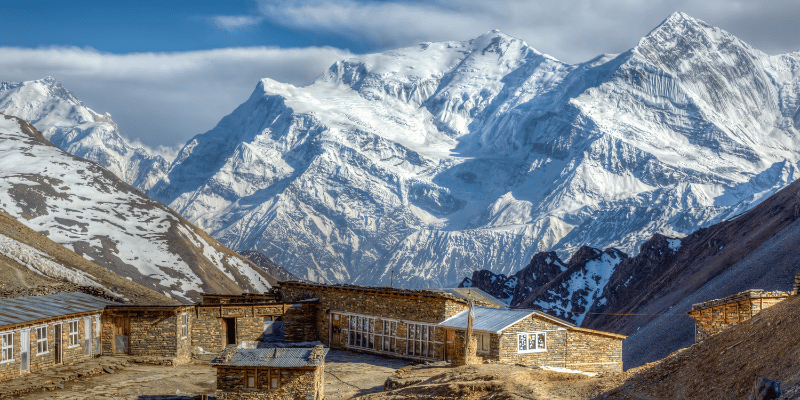
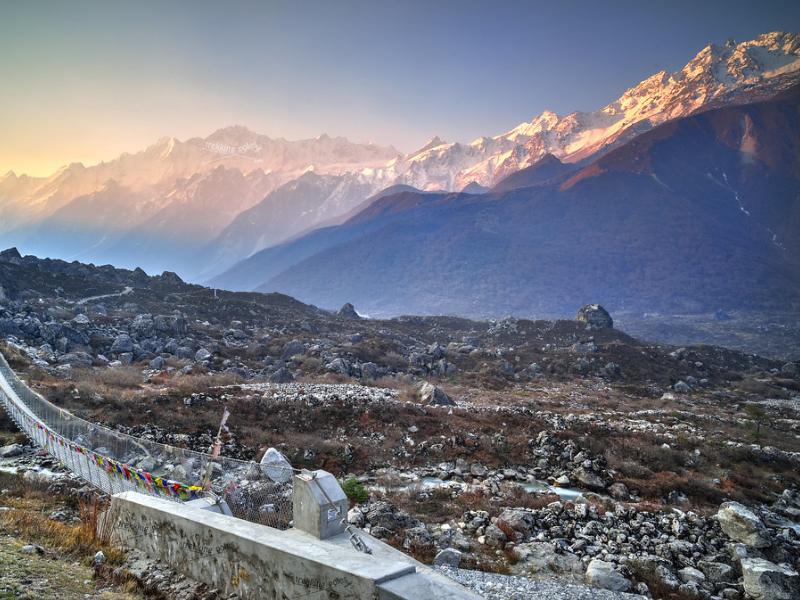
Snowy Trails Of The Annapurna Circuit Trek (Source: Greg Willis)
Practical extras that make the difference:
- Altitude: Stick to "climb high, sleep low", Manang rest essential. Symptoms (headache, nausea)? Descend immediately, no heroics. Guides spot issues early.
- Packing light: Daypack 5–7 kg max. Laundry in Manang/Marpha. 3–4 hiking outfits, quick-dry everything. Broken-in boots, no blisters.
- Food/water: Dal bhat powers you, order with extra veggies. Purification tablets/filter, avoid bottled plastic waste.
- Weather: Layers rule, mornings cold, days warm. Rain jacket always. Spring/autumn best; check Thorong La snow updates.
- Cash: NPR only trail, no ATMs post-Chame reliably. Bargain teahouse prices nicely.
- Eco: Stick paths, no single-use plastic, supports sustainable tourism.
This 19-day Annapurna Circuit Itinerary gives breathing room, extra acclimatization, side options (like Tilicho Lake detour from Manang, adds 2–3 days), and avoids burnout. Roads mean you skip repetitive lower sections, but the trail heart (Manang to Muktinath, Tatopani to Ghorepani) stays pure walking. Weather in spring/autumn is best; check for snow on the pass in early season.
If you're in Kathmandu now, spring is coming, rhododendrons will start popping soon. Pack layers, test boots, carry Diamox if prone to altitude issues, and chat with locals/teahouse owners, they know the trail better than any map. It's still one of those treks that changes you a bit every time. Safe steps.

Leave a Comment